Freycinet National Park
This is day 2-3 of our 11-day hiking and camping road trip circuit.
The next stop of our road trip was Freycinet National Park. Our driving destination, Wineglass Bay Carpark, was only a 2-hour drive from Bay of Fires or 3hs from either Hobart or Launceston. The road that goes South along the coast is very scenic and passes by several beautiful beaches.
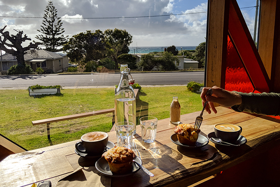
On the way there, it’s a good idea to stop for a coffee and a snack in one of the coastal towns. We had breakfast in an antique shop in Saint Helens. Yes, in an antique shop, which was also a cafe called Lifebuoy Cafe & Quail Street Emporium.
Then later on for a coffee and a tasty muffin at this really clever shipping container cafe called Swims East Coast Coffee in Scamander. This cafe was basically a cosy converted shipping container midway up a hill providing great views and warmth against the wind we had that day.
Both our hikes in this area started from Wineglass Bay Carpark. The carpark was quite spacious and offered drinking water and toilet facilities. It was very busy with day visitors when we arrived just before noon. So it’s better to get there either early morning or late afternoon.
There are multiple campsites on the peninsula with trails that go around following the coast for a longer 3-day-hike. Our plan, however, was to climb Mount Amos, return to the carpark then walk to the Wineglass Bay Beach campsite to spend the night there. Read on to see how it all turned out.
The climb to Mt Amos
- Time: 2hs return
- Distance: 4km
- Elevation gain: ~400m
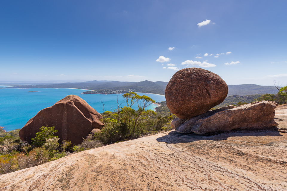
Mt Amos might not come across as an impressive mountain initially but the views from above are truly stunning. This trail is less taken as most of the tourists go to Wineglass Bay Lookout, an easier but less rewarding walk to a lower lookout.
The climb to Mt Amos will take less than an hour but there are some very tricky sections where you’ll need to use some rock climbing techniques. This climb would be dangerous in wet conditions as even on a clear day some parts are slippery.
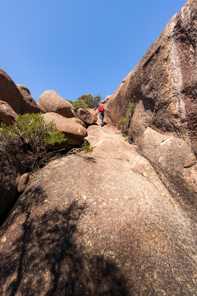
Having said that, we had seen young and old people doing this climb, people climbing with babies and even a guy descending the track, faster than us, wearing only thongs (flip-flops in America). So all the warning signs below should not deter you if the weather is good and you don’t mind climbing on all fours for the best possible views of Freycinet National Park.
Once you get to the top, the first thing you’ll see is the impressive view of Wineglass Bay Beach. From up here, if you look carefully, you may be able to spot the campground at the farthest point of this beach. The summit is a great place to hang out and rest from the climb but most likely it will be windy and cold so be prepared or seek shelter behind the many rocks found up there. The descent is slightly easier, you will have good views of Coles Bay and Dolphin Sands, a very long stretch of sand.
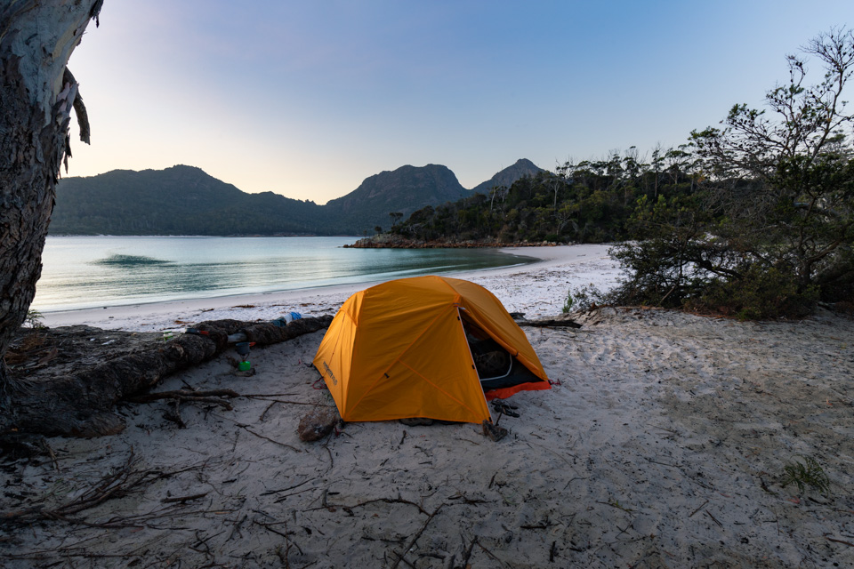
Wineglass Bay Campsite
- Time: 1h
- Distance: 4km
- Difficulty: Easy
- Toilets: Yes
- Drinking water: No
- Price: Free
- Bookings: No
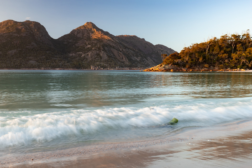
Tasmania has stunning beaches on offer. We thought nothing can top that beach-camping spot at Bay of Fires but we were in absolute awe of Wineglass Bay. This tranquil beach campsite is located at the Eastern end of the beach. This place feels remote but fortunately it doesn’t require too much effort to get there.
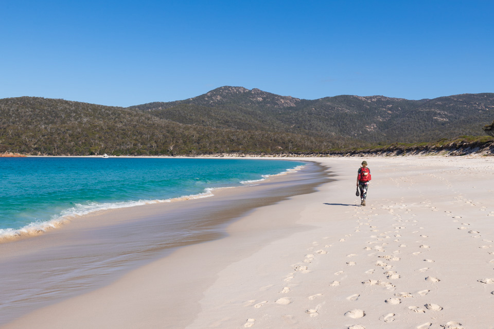
Starting from the carpark the trail first goes up passing by Wineglass Bay Lookout and then starts a short descent to Wineglass Bay Beach. From there, you’ll just need to walk along the beach to the end of it where there will be a sign of a campground.
Most of the camp spots are located in a bush area closer to the toilet and farther from the beach, but there are also spots just at the beach that offer spectacular views of the bay.
Back to the Carpark via The Isthmus Track
- Time: 3 – 3.5hs
- Distance: 10km
From Wineglass Bay campsite there is a trail that goes towards Mt Freycinet and around the Freycinet peninsula, we however decided to go back taking a longer route through Isthmus Track and Hazards Beach.
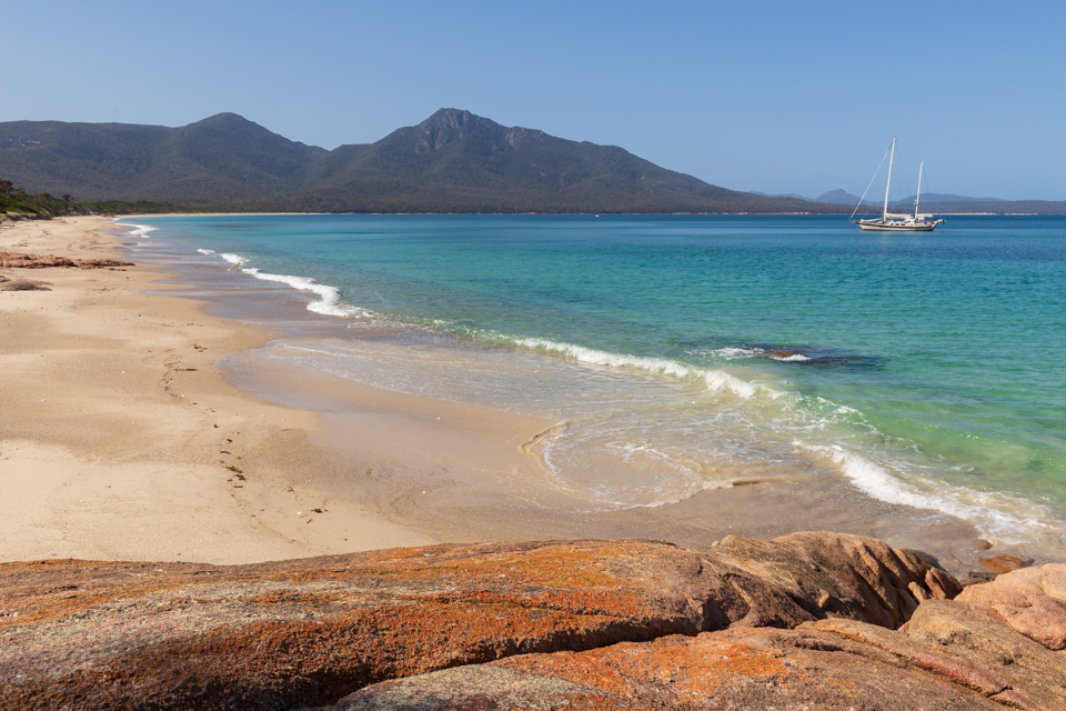
This track starts from the northern part of Wineglass Bay Beach and goes west through a bush area which is very quiet and well protected from the sun. Once it reaches the beach, it turns right and keeps going all the way to the visitor centre. Hazards Beach is a great place to have a quick dip and a lunch break, but once the track turns off the beach you’ll get more great views of Coles Bay. It’s really hard to get lost on this track so the only thing you need to do is enjoy the views.
After camping for 2 nights straight we drove south to our next hike to explore the rugged Southern Coastline and The Capes area.