Lake St Clair National Park
This is day 6-8 of our 11-day hiking and camping road trip circuit.
This park is the southern part of Cradle Mountain-Lake St Clair National Park and is home to the Overland Track, one of Australia’s most famous 6-day bushwalking track. We planned our trip so we can get a taste of this mentioned track, which would otherwise cost $200 and would need to be booked way in advance due to its popularity. With our desire for more freedom and tranquility we opted to spend our nights by Shadow Lake and Mount Rufus.
Upon arrival to Lake St Clair Visitor Centre we were presented with a full car park, friendly staff, a cosy restaurant, bathroom and shower facilities and plenty of hikers coming and going.
Before grabbing all our gear, we sat down by the majestic Lake St Clair, Australia’s deepest lake, to take a moment before spending the next two nights in the wilderness. Little did we know how blissfully remote our next two nights would be in Lake St Clair National Park.
Shadow Lake camping
- Time: 2.5hs from the Visitor Centre
- Distance: 6km
- Difficulty: Easy
- Toilets: No
- Drinking water: lake water (treated/boiled)
- Price: Free
- Booking: No
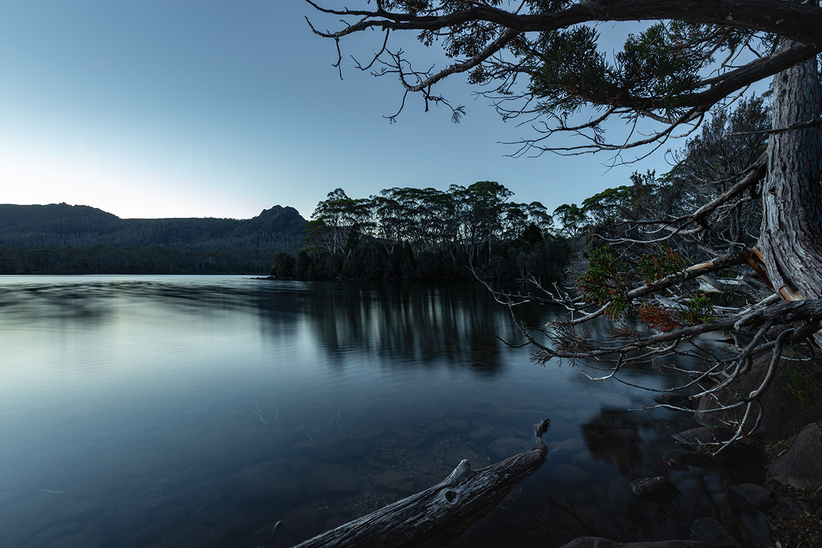
Arriving at 7pm, after 2.5 hours of walking from Lake St Clair Visitor Centre, we set up our tent by Shadow Lake. We settled at the junction of Little Hugel Track and Mt Rufus Track just by the bank of the lake. There were maybe 5 or 6 cleared spots for camping and it would had been very hard to find an appropriate place to set up the tent anywhere else because of the dense vegetation and swamp areas near the lake. As this area is not an official campsite, there were no facilities. Lake water was clean enough to use for cooking.
Mount Rufus camping
- Toilets: No
- Drinking water: No
- Price: Free
- Booking: No
Time: 2hs from Shadow Lake Distance: 3km one way Difficulty: Easy
Time: 4.5hs from the Visitor Centre via Shadow Lake Distance: 9km one way Difficulty: Easy
Time: 3.5hs directly from Visitor Centre Distance: 7.5km one way Difficulty: Medium. 700m climb. Max elevation: 1416m
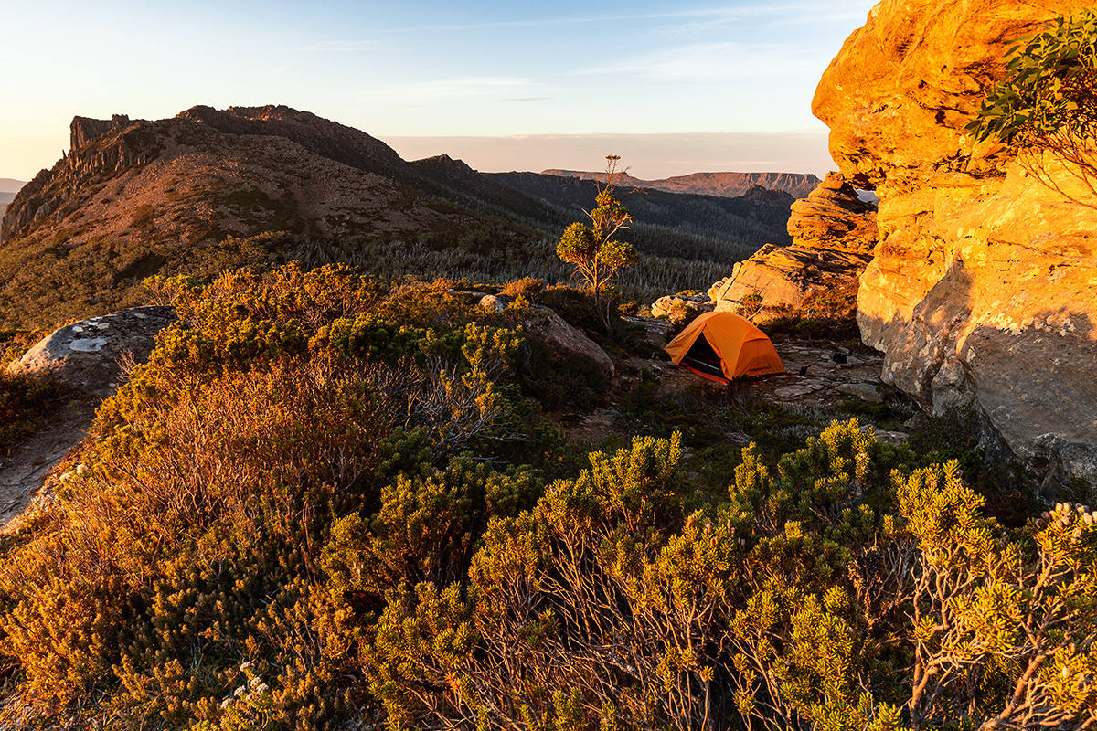
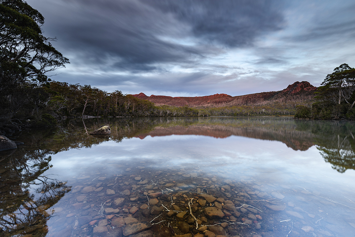
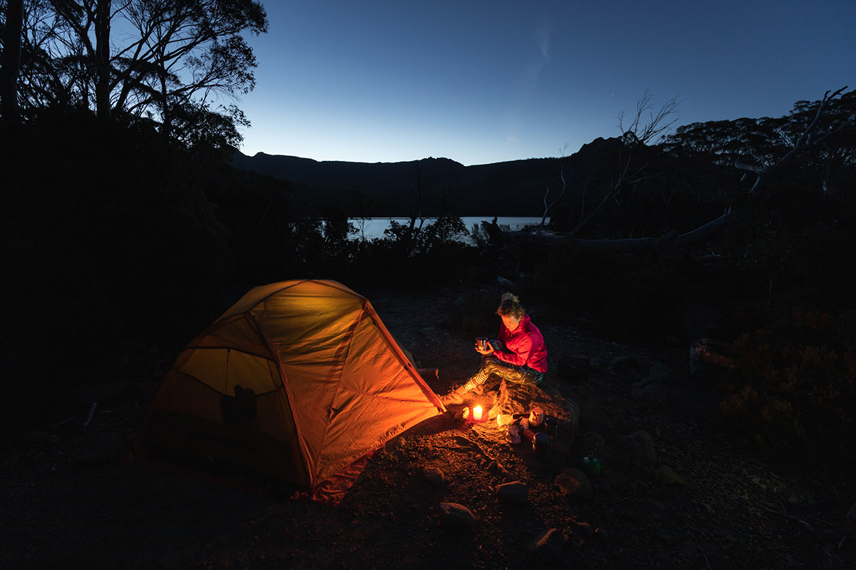
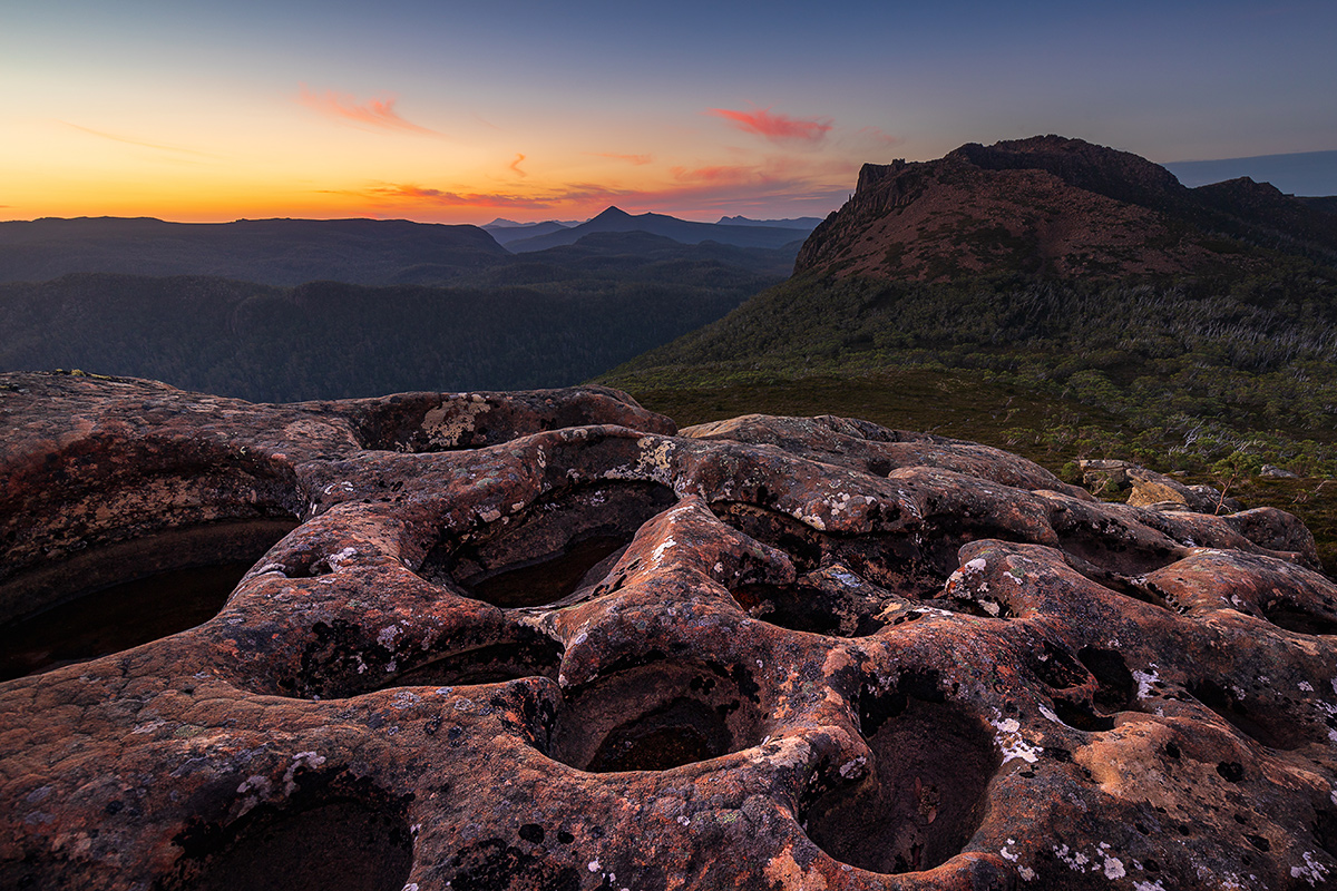
From Shadow Lake we followed the track to Mount Rufus. This track quickly leaves the bush area around the lakes and leads into a small valley between Mt Hugel and Mt Rufus. In about 2 hours we reached the saddle between Mt Rufus and Mt Hugel with beautiful rock formations. Our camping spot was just 30 minutes to the summit. It was truly a magical and peaceful site to spend the afternoon and night. This was wild camping at its best. There were no facilities and we were the only people in the area as far as we could see.
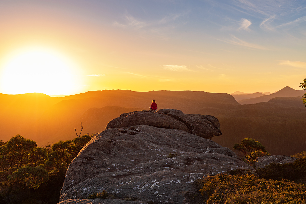
Early morning we were woken by strong gusting winds and we had to think twice about heading up to the summit. This reminded us once more about how unpredictable the weather can be and that it’s important to be prepared for different conditions and be flexible with our plans. We did, however, continue our way to the summit after layering up and putting on our wind jackets and it was worth it. The summit is the highest point in the area with its 1416 metres hence offers amazing views of its surroundings.

The track continued along the ridge and once we reached the other side of Mt Rufus, the winds eased and we had a pleasant descent with a view of Lake St Clair in the background. Then we descended below the tree line which gave us much appreciated shelter from the natural elements.
The last part of this hike goes through an ancient forest with moss covered trees that looked like they grew undisturbed there for centuries. Soon enough, in 2.5 hours from the summit, we were taking a refreshing dip in Lake St Clair.
Driving to Cradle Mountain NP
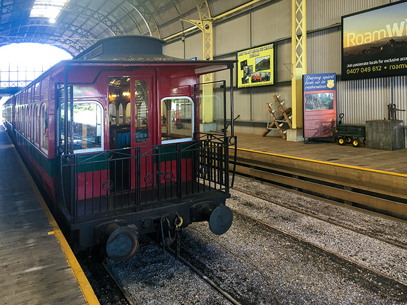
Tired, but charged with post-hiking excitement we headed to Cradle Mountain via a small mining town, Queenstown. Turns out that this seemingly deserted town attracts a significant number of tourists with the West Coast Wilderness Railway, an old steam train, departing to and from this town. The train goes to Strahan through a rainforest, mountain passes and gorges along a historic and scenic route.
Having enjoyed the beauty of wild camping and hiking in this remote area we headed to our last destination: Cradle Mountain National Park